
Grab your umbrella: rain, thunderstorms and mountain snow hit Colorado through Friday
Apr 30, 2026, 9:50 AM
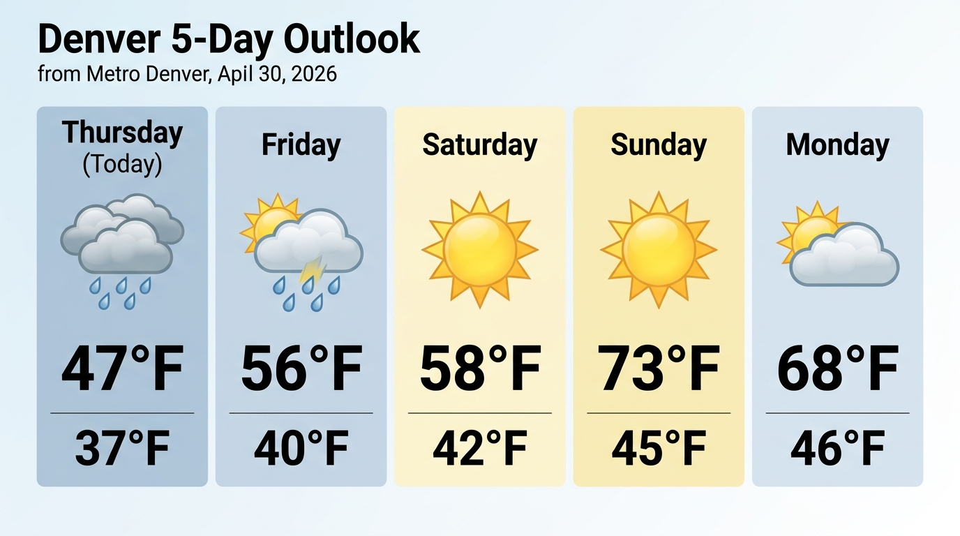
If you stepped outside Thursday and thought it felt more like late October than late April, you’re not imagining things. A strong spring storm system is rolling through Colorado, bringing scattered showers and cloudy skies to metro Denver with temperatures barely cracking the low 40s — that’s nearly 20 degrees below normal for this time of year. The National Weather Service says there’s an 80% chance of rain Thursday, and Denver7 reports the metro could see its wettest day since September, with the western and southern parts of the area picking up anywhere from a half inch to a full inch of rain by end of day. So yeah, definitely keep that jacket handy.
Up in the high country, it’s a full-on winter flashback. Significant mountain snow is falling Thursday, with 5 to 13 inches expected above 9,000 feet and snow levels hovering around 6,500 to 7,000 feet. A Winter Storm Warning is in effect for the Sangre de Cristo and Wet Mountains, where some passes could see 12 to 16 inches. The good news for metro Denver folks? The National Weather Service says nearly all of the Denver area should stay snow-free, though a few slushy flakes could sneak into the higher elevations of the Palmer Divide near Monument. And while all this moisture is welcome — especially given Colorado’s ongoing drought — forecasters warn it likely won’t be enough to move the needle significantly on drought conditions.
The light at the end of the soggy tunnel? The weekend is shaping up to be gorgeous. Friday should see lingering showers taper off, mainly staying in the foothills and mountains, with a high near 56. Then Saturday and Sunday look much more inviting, with sunshine returning and temps climbing to around 58 Saturday and jumping to a very springlike 73 by Sunday. Classic Colorado — four seasons in one week. Hold tight, it’s worth the wait.